Thanks to Micah at Inyo County SAR for sending me these coordinates. I'm pretty sure this is the spot where they found the pack. Go to Google Maps and copy and paste this into the search box:
N 36 33.80 W 118 17.60
The green arrow marks the spot. You can click on different views to see a map, satellite view, and terrain.
You can also see where the trail ends at the summit, and the fork in the trail. Wade climbed up the trail that disappears off to the right, and possibly went down the trail that switchbacks to the left.

Subscribe to:
Post Comments (Atom)

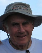

Michelle, Our son was one of the three hikers who last saw and talked with Wade. SAR has interviewed B.D. and if it would help in anyway he would speak with your family. The three hikers were seriously impressed by Wade's fortitude thus one looked back and took his picture. Remember, they had spoken with him at 4:45am so seeing him again at 3:45pm was an inspiration to them.(Kindred and tired spirits) They knew he had been hiking longer than they had. Know the three hikers and their families have been concerned and in prayer for Wade.
ReplyDeleteDear Jeanne and family,
ReplyDeleteTim and I were so sorry to hear of Wade's passing. We will miss his naturist spirit. We were so hoping that he would be found alive and just resting at some point of the trail. If there is anything we can do, please let us know.
Tim and Olga